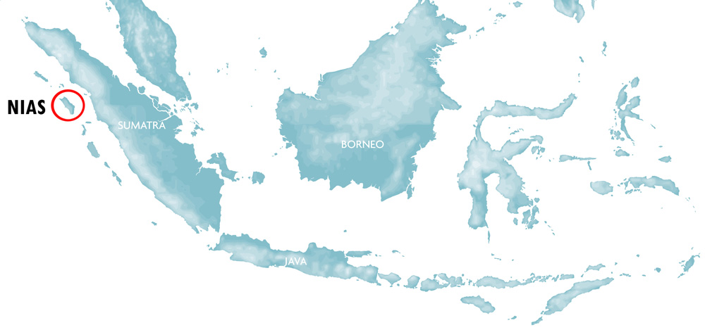
Sailing and cruising around Nias Island
Sailors have used Nias for supply and safe anchorage for centuries. Chinese, Dutch, Portuguese and English sailing ships were the first recorded visitors to Nias. Some of the first tourists to arrive in Nias were long-distance sailors exploring the west coast of Sumatra. Not long ago this part of Indonesia was considered unchartered territory as far as cruising went. By word of mouth it became known in the sailing community that Nias offers good and protected anchorage. Since some Nias harbors were listed in the yachting bible “101 Anchorages within the Indonesian Archipelago” the number of visiting sailing boats has steadily increased. Today many sailors cruising Indonesia prefer the west coast of Sumatra as the east coast and the Malacca Strait is becoming increasingly crowded. The north-west Sumatra barrier islands (Simuele, Banyaks, Nias, Batus and Mentwai Islands) is one of the areas with least boat traffic in all of Indonesia, which makes it ideal for sailing. There are literary thousands of small islands, beaches, surf waves and reefs to explore and for sailors who want to leave the trodden path, Nias is the perfect place for it.
For detailed charts including approaches, way-points and GPS coordinates use charts or books such as Cruising guide of Indonesia available in both hard and soft copy.

Sailing yacht anchoraged in Lahewa lagoon.
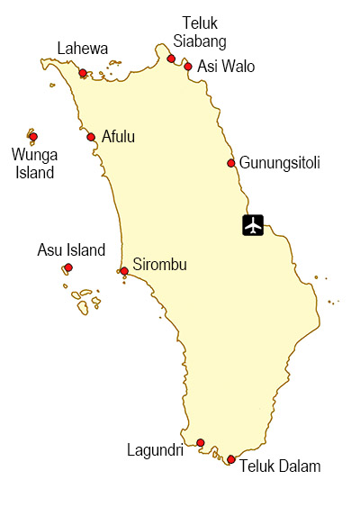
Anchorages around Nias Island
Lahewa, North Nias (Nias Utara)
N 1.398303°, E 97.172028°
Lahewa is a small town located in the north-west corner of Nias Island. The harbour is located inside a large, very well protected lagoon. The lagoon is between 10-18 meters deep with mud bottom, making anchorage safe and easy. During rough weather it is an ideal location for shelter. Since reconstruction after the 2005 earthquake, the harbour has a new pier and today Lahewa is an excellent place both for safe anchorage and stocking up on supplies. Some sailors dock right next to the pier, but most choose to anchor further out in the Lagoon. Lahewa harbour officials have received positive feedback on several online sailing forums for being friendly, courteous and helpful. Even though Lahewa is basically a large village with very few English speakers, sailors will be able to get fuel, supplies and fresh vegetables and fruit here. Other services available are basic repairs, bank, internet and transport to Gunung sitoli. Lahewa is a popular stop for boats coming or going to Simuele Islands.
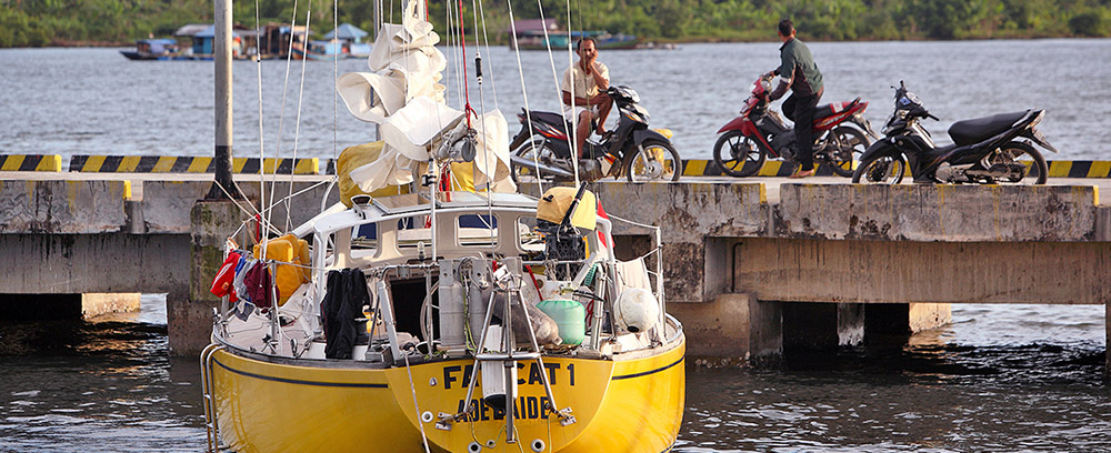
Sailing yacht at the pier in Lahewa harbour.
Teluk Siabang, North Nias (Nias Utara)
N 1.51297°, E 97.37548°
Teluk Siabang is a large protected lagoon with good anchorage in the north-east corner of Nias. Local fishermen use this lagoon and there is a small pier here. It’s a good place for spending a quiet night. 1.5 kilometers east of here is another bay called Siaba Bay (N 1.507086°, E 97.387996°) which also offers good anchorage. Both these places are beautiful and peaceful but there are no facilities here.
Asi Walo-Teluk Bengkuang, North Nias (Nias Utara)
N 1.51034°, E 97.42496°
Teluk Bengkuang is a small protected lagoon with good anchorage in the north-east corner of Nias. This used to be a very busy harbour before the roads to North Nias was built. Local fishermen still use this lagoon for anchorage. There is a small beach with a restaurant here. On Sundays it is a popular place with local people. Some good reefs for snorkelling in the bay.
Afulu, North Nias (Nias Utara)
N 1.26093° E 97.24285°
Afulu is a small village on the northern part of the west coast of Nias. This is another great choice for sailors visiting Nias. Like Lahewa, Afulu is a large, protected lagoon with safe anchorage. There is a small pier here, but it is difficult to access and most boats anchor in the northern end of the lagoon just off the beach. Afulu village is 5 minutes walk inland from the pier, where fresh vegetables, fruit and other basic supplies can be found. There are several famous surf waves in this area and during May to October surf charter boats often anchor here. This lagoon is very scenic and it’s a great place to spend a few days.
If you need help with anything contact Mr Darius or his brother Makmur at their shop ‘Toko Darus’ in the village. The brothers speak some English and often helps visiting sailors and surfers.
Wunga Island, North Nias (Nias Utara)
N 1.22191°, E 97.09294°
Wunga Island is a true paradise island off the northern west coast of Nias. Wunga used to be two separate islands and there was good anchorage between them. But after the 2005 earthquake and the two meter land uplift, the Islands are now connected. The large lagoon is incredibly beautiful but it’s too shallow for most sailing boats to enter. Today most boats anchor just outside the entrance to the lagoon. If the weather is rough, Afulu is a better option as the anchorage here is not the best. During calm conditions, this is a great place to spend a day or two. Use a dinghy to enter the lagoon and explore the beaches around the lagoon.
Sirombu, West Nias (Nias Barat)
N 0.945957°, E 97.416646°
Sirombu is a village and port in the middle of the west coast of Nias. It is easy to find as Sirombu is a very prominent feature of this coast line. Boats enter a sheltered area between a headland and a small island. There is a large pier here next to a beach. There are some seafood restaurants at the beach but the actual village is a couple of kilometres inland.
Asu Island, West Nias (Nias Barat)
N 0.905840°, E 97.280192°
Asu Island is the most northern of the Hinako Islands, 15 kilometers west of Sirombu on the west coast of Nias. Tourists come here to surf, snorkel and enjoy the beach at one of three surf camps on the island. Most sailing boats anchor on sandy bottom in front of Mama Silvis Cottages. It’s a great beach and cold beers with great food can be had here. During calm conditions it is a good place but it’s not the most sheltered locations during rough weather. Beware of the reef one kilometres off the beach from Mama Silvis.
Sailing boat in Lagundri Bay, near the famous wave in Sorake.
Lagundri Bay, South Nias (Nias Selatan)
N 0.576873°, E 97.737866°
Lagundri Bay is located in the south-west corner of Nias. Lagundri is well known by surfers all over the world because of the wave on the northern side of the bay (Sorake). This is one of the best and most consistent waves in the world. Most of the tourists heading for Nias is coming here and there are more than 30 guesthouses along the shore. Despite the swell there is protected anchorage inside the bay. During the swell season April to September it can actually get a bit busy here when surf charter boats and sailing yachts congregate inside The Point. Lagundri is very different from other anchorages around Nias. Many locals speak English and are very outgoing. If you have been off into the wilderness, this is a good place to interact with people from all over the world.
Teluk Dalam, South Nias (Nias Selatan)
N 0.567604°, E 97.821465°
Teluk Dalam (Deep gulf) is the second largest town on Nias, located in the southern tip of the island. The port is located inside a one kilometre deep bay that offers good shelter all year. Even though it is open to the south, the swell does not come into the bay and many fishing boats and smaller freight ships dock here. There are many shops and services available here such as ATMs, Banks, and restaurants. From Teluk Dalam it is a 2.5 hours drive to the airport.
Gunungsitoli, (Former) capital of Nias
N 1.295023°, E 97.613890°
Gunungsitoli is the largest town on Nias located in the northern part of the east coast. The town stretches out for more than 10 kilometers along the coast and it is fine to anchor anywhere here, the conditions are pretty much the same. The center of town is just south of the area where there is a large concrete “Ya’ahowu” (welcome in Nias language) sign facing the ocean. Sailors come to Gunungsitoli to visit the museum, or to make repairs and stock up on supplies. There are many shops and markets in town and all kinds of services are available here. An easily accessible and safe place to tie up a dingy is at pier of the Museum Pusaka Nias, 600 meters north of the Ya’ahowu sign (look for the big Museum sign facing the sea). The Museum welcomes sailors and the staff there are very friendly. If you need help with anything there are always a few English speaking staff around who can assist you. You can catch a becak (motorbike rickshaw) from the museum gates to nearby shops and banks. The Museum compound itself is a nice place to relax, with a small cafe, guesthouses, gardens, library and an interesting exhibition of Nias cultural objects.
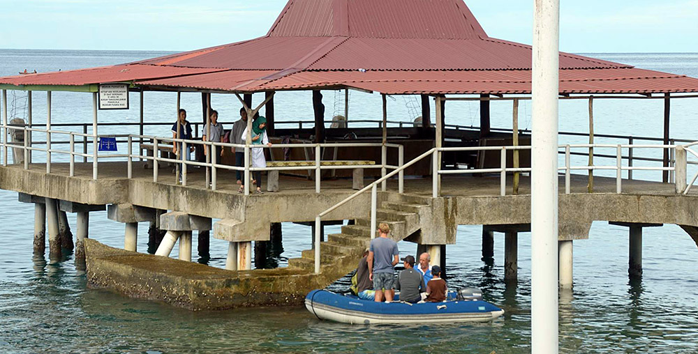
Dinghy landing at the Museum jetty in Gunungsitoli.
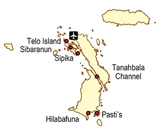
Anchorages around Telo Islands – Pulau Pulau Batu
South of Nias is a group of islands known as the Telos. The Indonesian name is Pulua Pulau Batu (Rocky Islands). It is sometimes called 101 islands, but that also includes small rocks and tidal reefs. Telos consists of three larger islands surrounded by a number of smaller (41) islands. The Telos is situated almost exactly on the equator. Due to its remoteness the Telos doesn’t see that many tourists but is known for its niche high-end surf resorts. For sailors this is a very beautiful area with many hidden bays, channels and small islands.
Telo (Town), Telo Island
S 0.054169°, E 98.285798°
Telos is not the largest island in the Telos archipelago (Batu Islands) but it is where the main town and administrative center is located. Most sailors have to stop here for fuel and provisions, but move on to nicer anchorages for the night. It is possible to anchor very close to shore. There are several pier and jettis where visitors can tie up their dingy. Basic supplies and services are available in this little friendly town
Telo South, Telo Island
S 0.089412, E 98.288726
This anchorage is located four kilometers south of town on the east coast of Telo Island, near the southern tip. Most sailors prefer to spend the night here rather than in town. South of this anchorage, on the northern side of Sibaranun Island there are beautiful beaches and surfing.
Sipika Island
S 0.136969°, E 98.345350°
A very good year round anchorage located near the southern point of Sipika Island in front of a beautiful beach. A bit further south of the anchorage there is a high-end surf resort and a kilometer north of there is a village. There are several good waves nearby, particularly the one on the southern point of Sipika.
Tanahbala & Tanahmasa Channel
S 0.266471°, E 98.471546°
Between Tanahbala and Tanahmasa there is a one kilometre wide 22 kilometer long channel that is easily navigated. There are several nice and safe anchorages here.
Pasti’s / Surfing Village, Tanahabala Island
S 0.554357°, E 98.489328°
This is a narrow bay located on Tanahabala Island near the most southern point of Telos. This anchorage is very scenic and offers good protection all year. There is a small village and a pier here with a few shops and fresh water. One kilometer south of here on the western shore is a surf resort call Surfing Village. The friendly owners welcomes visitors and you can have dinner and cold beers here. The name Pasti (‘For Sure’ in Indonesian) is the name of the surf wave near the resort. This anchorage is often used by people coming from, or going to the Mentawai’s.
Hilabafuna, Tanahbala Island
S 0.565736°, E 98.417413°
Hilanafuna village is located near the southern point of Tanahbala Island. The anchorage is in front of the village on the western side of a large lagoon with calm waters and white beaches. There are a few reefs around the anchorage so be careful during the approach. Just around the corner to the south-east is a nice surf wave.
NIAS ANCHORAGES
TELO ANCHORAGES
CRUISING GUIDES FOR NIAS
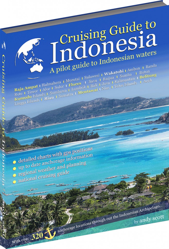
Cruising Guide to Indonesia
By Andy Scott (2014)
With over 320 anchorages, Cruising Guide Indonesia covers everything the navigator needs to safely cruise Indonesian waters. Digital e-book versions also available and West Sumatra chapters included Nias and Telos can be downloaded separately.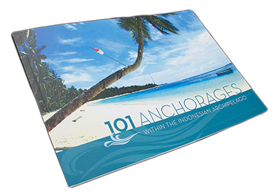
101 Anchorages Within the Indonesian Archipelago
By Geoff Wilson (2007)
A collection of seafarers notes on 101 anchorages throughout Indonesia, including the west-coast of Sumatra. This text helps all sailors get off the beaten path and find their own piece of paradise.
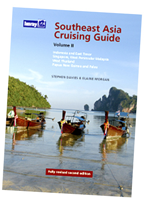
Southeast Asia Cruising Guide Vol II
By Stephen Davies and Elaine Morgan (2008)
This is the only guide that covers the entire length and breadth of a region frequently visited by round-the-world sailors. This edition concentrates on the most frequented routes and includes the most popular stops.
Sailors Say:
Lahewa was a very sheltered anchorage. We chose to anchor in view of the wharf in good holding mud. We brought “Erica” alongside this very good wharf and siphoned fuel into our tanks.
Eric & Cathy Gray, SY Erica
It was so very calm in Lahewa Lagoon. The songbirds in the trees, a fisherman played some music and another fisherman sang some pleasant songs. We felt we were a million of miles from anywhere, in a hidden little corner of the lagoon.
Darrel & Loretta Smith, SY Cantaka
We stopped in at Afulu and was greeted warmly by all the locals especially Makmur and his brother. A small village with a good walking path got us exploring the area.
SV Ultimate Dream
Asu has a great calm anchorage just around the headland from the point where the left handers waves are found. You always appreciate a nice calm anchorage at night.
Clarrie Bouma, The Huey
Next stop Asu Island and sampled the famous Mama Silvis cooking, and it was good. Her good food and hospitality kept us coming back for more.
Rickard & Susannah, SV Ultimate Dream
Lagundri Bay is wonderful anchorage. A tropical wonderland, this crescent shaped bay is fringed with coral reefs and sandy beaches. It is a magnificent spot, lots of friendly locals.
Keith Stirling, Surf Machine
We spent three days anchored in Lagundri Bay. We were anchored a bit deeper in the bay inside of the break. It is a good anchorage but can get a little rolly.
Leon Bowles, SV Bombora
Between Nias and the Batu Islands we crossed the equator. The Batu Island group was really pretty beautiful and had enough closely spaced islands to give us some great calm anchorages.
Leon Bowles - Bombora
Having arrived at Pulau Sipika I keep thinking it can’t get much better than this and somehow it does. The water is crystal clear and the locals are friendly.
SV Sadiqui
VISIT NIAS ISLAND
 Sharing the wonders of Nias Island with the World! VISIT NIAS ISLAND is a campaign to promote Nias as a tourism destination
CONTACT US

