North Nias Regency
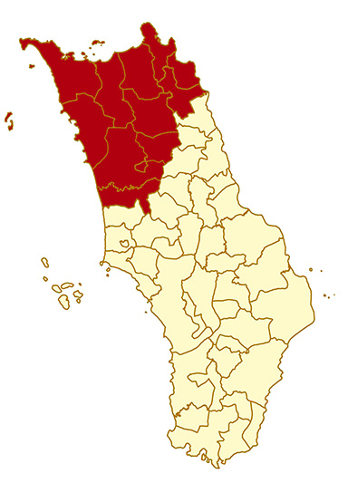
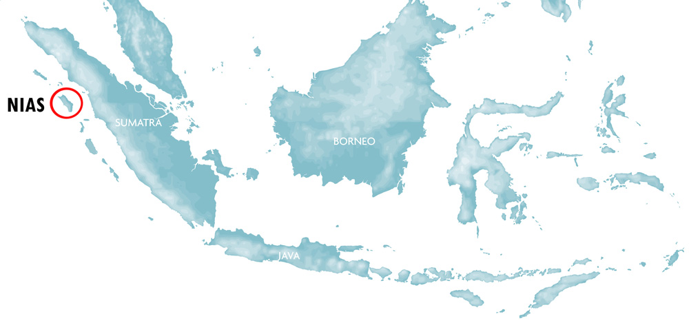
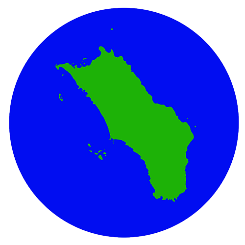
North Nias Regency covers the top part of Nias Island and is known for it’s a stunning coastline with many sandy beaches and small paradise islands. Mostly untouched by modern development this is a very peaceful and beautiful corner of Nias. Some 20 years ago the north-west of the island was one of the most undeveloped and inaccessible areas of the Island. The first visitors to the north came by boat looking for undiscovered surf waves. The village of Afulu on the northwest coast became popular with a small crowd of adventurous hard core surfers who didn’t mind staying with local families or in very simple beach huts. Today the only dedicated tourist accommodation in the area can be found in Afulu. As the roads to this area are now vastly improved the North is discovered by all kinds of travellers. At the moment North Nias has less foreign visitors than most other parts of Nias. This doesn’t mean that it has less to offer; on the contrary the north has more beaches, islands and wild nature than any other part of the Island. What North Nias lacks in infrastructure it makes up for in natural beauty. Travellers to North Nias are rewarded with unique experiences; being the only person on a beautiful beach, having a surf wave all to yourself or hanging out with locals who rarely meets outsiders.
Here are some things you can see and do in North Nias. For a full list of places check the sidebar of this page. More in-depth information about North Nias can be found here.
Beaches
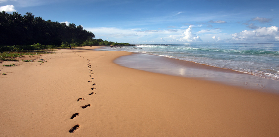
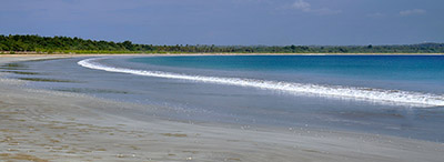
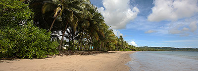
Wild beaches along the west-coast of North Nias Regency.
In North Nias Regency alone there are 46 beaches with a combined length of over 70 kilometers. Needless to say there is something for everyone here; from small secluded beaches in hidden coves to long open beaches where you can walk for hours without seeing another person. Some well-known beaches are located right next to villages and are full of activity, while others are so far away from populated areas that they don’t even have a name.
The 2005 earthquake raised the whole island and tilted it on its side. This dramatically changed the coastline, especially in the north-west where the uplift was measured to be 2-2.5 meters. The effect of the uplift can clearly be seen today as many west-coast beaches are now very wide and the old coast line (usually where the tall coconut trees grow) is several hundred meters inland from where it used to be. In some places beaches disappeared while new ones were created elsewhere.
West Coast
The ‘wild’ west coast has the most pristine and longest beaches North Nias. This is one of the least populated regions of the Island and it’s possible to walk along some beaches for hours without seeing another human being. During storms the west coast faces the full fury of the Indian Ocean. During May to September there is a lot of swell here which in places creates world class surf waves. This is great for surfers, but not so good for fishermen, which is one of the reasons the west coast is so sparsely populated. Sections of the west coast are very inaccessible which means some beaches are difficult to reach, but on the other hand they are completely natural. Around Afulu there are some beautiful beaches which are very accessible. Pantai Walo (or Turedawöla) is the “surfing” beach, also good for swimming in the southern end. North of here is Pantai Pasir Merah (Red sand beach), known for its beautiful sunsets. South of Afulu is Pantai Pasir Putih (White sand beach) and Laosi-Laosi Beach. In the northern corner of Nias is a four kilometers long beach called Toyolawa. Toyolawa is also a working coconut plantation. Swimming in the north end is good. Between Toyolawa and Afulu there are many amazing beaches but they can only be reached by motorbike and also involves walking a few kilometers.
North Coast
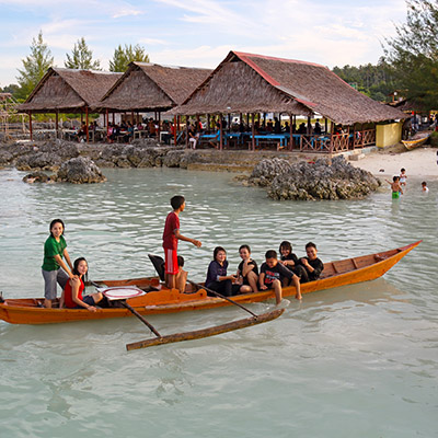
Tureloto near Lahewa in North Nias.
The north-coast has a large variety of beaches; some of the most popular with local people as well as long stretches of isolated and inaccessible coastline. Just off the coast there are some small islands that offer a completely different experience. Several large rivers meet the sea on the north-coast and mangroves often grow around the river mouths. After heavy rains water clarity can be affected by river run offs. The north coast is more protected than the west coast, but there can still be waves and currents at some exposed beaches during the May to September period. Tureloto on the north-west corner of Nias is famous for its large lagoon which was created during the 2005 earthquake land uplift. The lagoon is very scenic and offer safe swimming in all conditions. The outside reef facing the ocean is one of the best freediving places on Nias. On Sundays many locals come here after church.
In front of the village of La’fau there is another beach, which is also popular with locals.
East Coast
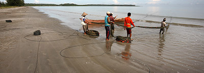
The east-coast is the most protected part of the coast and many fishermen live here. This is the most populated and most accessible part of North Nias. It only takes an hour to drive from the airport to the North Nias east-coast and the main road from Gunung Sitoli, the main town on the Island, runs parallel to the coast. This makes some beaches here easily accessible, for example Tanayae Beach in Tuhemberua.
On weekends many local people and domestic tourists gather at Fofola and Asi Walo beaches. But there are also some beaches where it’s possible to relax in peace and quiet. Seriwa’o and Lakha beaches are beautiful and unspoiled locations which see very few visitors except local fishermen. Because the east-coast is protected from large waves and ocean currents it is safe to swim anywhere and at any time of the year.
Offshore Islands
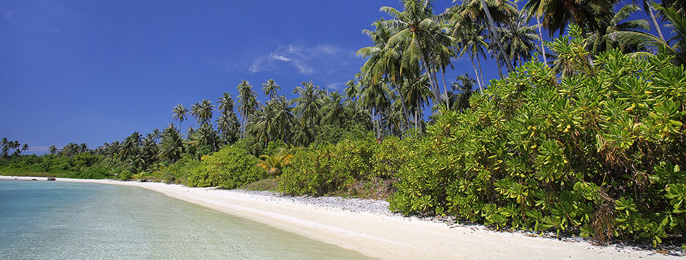
Beach on the northern side of the lagoon on Wunga Island. Afulu, North Nias.
Many beautiful islands dot the coastline of North Nias. A number of these islands were created by uplifting during the 2005 earthquake. Many existing islands also increased in size and changed shape during this event. The effect can clearly be seen when visiting one of the islands and seeing all the exposed coral reefs that were previously submerged. Some of the larger islands display all the qualities of a tropical paradise island; sandy beaches, swaying palm trees with clear blue water. A trip to these islands can be arranged by chartering a local boat at a nearby harbour. One of the most interesting and beautiful Islands is Pulau Wunga off the west coast. This island used to be two smaller ones, but after the earthquake and uplift, Wunga is now one island with a huge lagoon inside. The lagoon is lined with beaches and outside the entrance is very good coral reefs. Closer to the shore off the north-coast are Pulau Lafa’au, Pulau Makora and Pulau Panjang. All three islands are very scenic and have small beaches and good swimming. Pulau Sarangbaung is the most northern point of Nias. This island has a lot of potential but is seldom visited due to the distance from the mainland.
Nature
Rivers, Waterfalls and Lakes
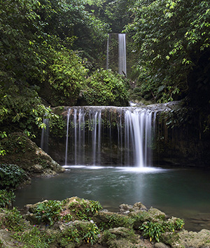
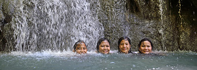
Luaha N’droi waterfall, North Nias.
The hills of Nias are the source of many rivers. As the rivers meander their way down the hills, they are sometimes interrupted by waterfalls. There are 10 known waterfalls in North Nias. Some of them only run seasonally, others are very remote. The following waterfalls run all year and are accessible to visitors; Luaha Ndroi, Tögi Gana’a and Helewuti (Bohoya) Waterfalls. In the southwest corner of North Nias lays the only real lake in Nias, Lake Megötö. The area around the lake is one of the wildest in Nias and it’s a hard 1.5 hour trek to the lake from the nearest road. Perhaps more interesting than the lake itself is the wildlife in the area. Many birds that have become extinct in other parts of Nias can be seen and heard here. The elusive Nias Myna is rumored to have been sighted around the lake. The Nias Myna is a rare bird endemic to Nias Island. Widely sought after for its beautiful song voice it has been hunted ruthlessly to the point where it may be extinct in the wild. A somewhat bizarre place is Kara Sangadulo in Alasa where locals claim egg shaped rocks are “born” from a river bank as if by magic! With or without supernatural forces at play this is a nice place to relax and have a swim on a hot day.
Caves
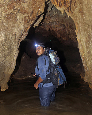
Caving in Alasa, North Nias.
There are many limestone caves across Nias Island. In North Nias there are 15 known caves, but it is believed that there are many more. Local mythology often involves tales of spirits and giant serpents living in caves. As a result most Nias people are afraid to go near them. Caves were used as a hiding place during inter-tribal warfare and fighting against the Dutch. Some of the known caves have not been fully explored and it is possible that long underground cave systems exists, waiting to be discovered by adventurous cave explorers. Most caves are located in Alasa and Alasa Talumuzoi sub-district, for example Nisui’arö , Tögi Heno, Tögi Banua, Simangani, Gua Naworia and Tögi Wiro caves. Tögi Heno cave is particularly interesting with several hundred meters of tunnels where its possible to walk upright deep into the ground. It is believed that this cave have several more unexplored side tunnels.
Cultural Heritage
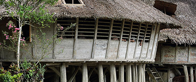
There are variations in traditional architecture across the island; North Nias houses (Rumah Adat or Omo Hada) are distinctly different from those in the south. Northern houses are free standing and oval shaped, while southern houses are rectangular and built next to each other. Compared to the south there is much less cultural heritage sites in the north. For centuries Acehnese slavers raided the north and settlements were small and hidden away deep in the interior. Headhunting parties from the south also regularly attacked northern villages. As a result parts of the north were almost uninhabited. When Christianity was introduced it spread from the north, and cultural practices were abandoned here earlier than in the south. Today there are still traditional houses and megaliths to be seen in the north, but they are fewer and more spread out than in the south. The best place to see traditional houses in North Nias is in Alasa and Tugala Oyo sub-district, which can be reached in a couple of hours from Gunungsitoli. The most traditional settlement in the north is Humene Sihene’asi village in Tugala Oyo Sub-district, which has 13 traditional houses in very good condition. Currently access to this village is restricted to motorbikes or four-wheel drive vehicles.

Traditional North Nias houses (Omo Hada) in Tugala Oyo sub-district, North Nias.
WW II Relics
During World War II Japanese troops were stationed on Nias. Bunkers and fortifications were built around the island in preparation for an allied invasion. Some very interesting war relics can be seen to this day on the west coast of North Nias. Ambukha hill was used as a look out for the west coast, and the Japanese constructed a command centre here. A few kilometers to the north two bunkers were built overlooking the expected allied invasion site at Toyolawa beach.


