Nias Regency – Central Nias
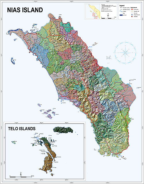
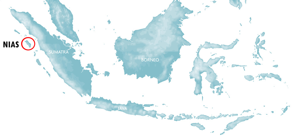
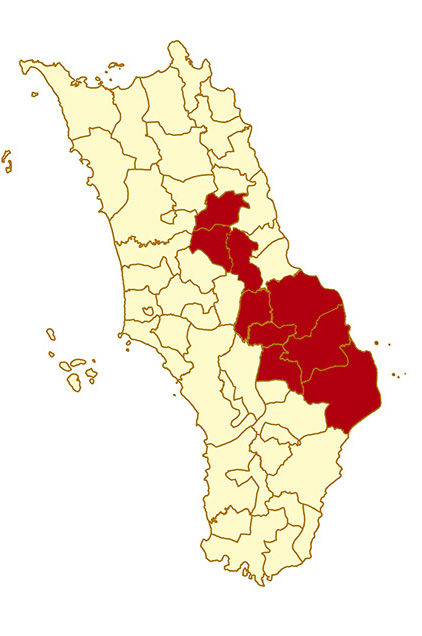
Nias is the name of a Regency in east-central Nias. Originally Nias Island was one Regency (Kabupaten Nias) but during a strive for greater regional autonomy in Indonesia Nias was split in two, then five regencies. Nias people also call this district Nias Induk. Today most visitors bypass this region as they head south for the more famous surfing areas and traditional villages. This doesn’t mean that there aren’t things to do and see in Nias district, it’s just a bit harder to get to. There are three regions of Nias Regency; in the east there is the coastline lined with beaches and coconut trees, in the middle is the flat agricultural area along the main south-north road and in the west the forest covered hills of the interior.
The Coast
The 60 kilometer long coastline is completely undeveloped, and there are only a few small fishing villages here, the largest one called Bözihöna. Some of the beaches along this coastline would probably be very nice to visit. Others that are close to mangrove swamps and river mouths more resemble mudflats than beaches. These areas are hard to access, as there are few roads here. During low tide it’s possible to travel along beach and mudflats on a motorbike, otherwise a boat is the way to go. The most interesting thing about this coastline are four small paradise islands near the eastern tip of Nias Island.

Pulau Musi, one of the small islands off the coast of Nias Regency.
The Center
This is the part of Nias Regency that travellers pass on their way south. It starts south of Binaka airport and ends just before the road reaches the coast in South Nias. Along the way travellers will pass the gentle hills and farming areas of Gidö, Idanö Gawö and Bawölato sub-districts. This is one of the flattest parts of Nias and as a result much of the rice grown on the island comes from here. The main north-south road is in very good condition and during the trip travellers can observe the simple country life of Nias as you are passing many small villages and settlements along the way.
The Interior
The area called the interior of Nias Regency is located west of Gunungsitoli and west of the main north-south road. This region consists of steep hills and mountains covered in forest. Rivers cut through the hills and nestled in the river valleys are many small settlements living a simple life of subsistence farming. No doubt this beautiful region hides many interesting things to see and do, but because the lack of access tourists rarely come here. A handful of adventurous travellers sometimes join local guides to do the Gido to Gomo trek.
Islands
Without a doubt the highlight of Nias Regency are the eastern Islands. People who manage to arrange boats here can enjoy the beach, the tropical island vibe and some very good snorkelling.
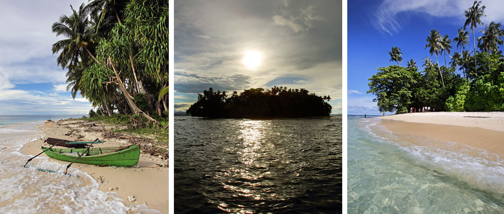
Small paradise islands off the east-coast of Nias Regency.
Onolimbu N 1.075696°, E 97.904253°
This is the largest island in this area. There is a nice beach on the west side of the Island. This is the only eastern island where people live. There are a few houses hidden away under the coconut trees on the east side of the island. Near the beach the local tourism department has built a few day shelters. The best snorkelling can be found by walking northward along the beach until it ends. Enter the water here and keep swimming north to the best section of the reef.
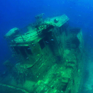
Ship wreck off Pulau Musi.
Pulau Musi N 1.079867°, E 97.929534°
A small uninhabited island 2.5 kilometers east of Onolimbu. This is possible the most beautiful of the four islands and another great spot for snorkelling. Being even further from the mainland the water is often clearer here. Just like Onolimbu, the best snorkelling can be found in the northern corner of the island. On the north-east side of the island there is a wrecked ship that sunk in 2004. To find the wreck just follow the reef and look for debris on the bottom. The top of the boat is only a few meters deep and during low-tide its possible to freedive into the wheel-house. Pulau Musi is so small that it is possible to snorkel around the whole island in an hour or two. During low tide you can walk around the whole island in 15 minutes.

Freediving on Soma Island.
Pulau Soma N 1.024781°, E 97.9545530°
Pulau Soma is eight kilometers southeast of Onolimbu and has very similar features. The beach is located on the west side of the island. Snorkelling is beast on the northern side.
Pulau Somambawa N 1.022925°, E 97.965652°
A tiny island one kilometers east of Pulau Soma. Small enough to swim around the whole island. 1.5 kilometers north-east of this island there is an interesting Goso (underwater reef) that can be visited if it’s not too choppy.
Getting to the Islands
To get to the islands you need to arrange a boat from Gunungsitoli or nearby Bözihona village. From town it takes almost three hours and you need a large boat. In Bozihona there are many small boats and the trip to the island is not that long. But getting to Bözihona involves a 45 kilometer drive from town on some very rough roads. Inquire with local tour operators about exploring these Islands.
Things to See & Do
Throughout the interior of Nias district here are many interesting cultural and natural attractions. Most of them are scattered in remote areas and since the access can be difficult these places receive very few visitors. With a bit of planning it is possible to have a great day out exploring waterfalls and caves and visiting villages with traditional houses and megaliths. The places on this list can be reached by a 1-2 hours’ drive from Gunungsitoli. It’s best to go with a local guide, especially if you don’t speak the language. Many smaller villages are not sign-posted but government buildings, schools and churches often have the name of the village on them.
Hiliserangkai sub-district
Hiliserangkai is reached by following the main east-west road across the island out of Gunungsitoli. The road is referred to as the Gunungsitoli – Sirombu (Nias Barat) road and is clearly marked. Some 10 km’s out of town (c. 30 minutes’ drive) start looking for traditional houses along the road.
- Lölöwua village (1.21279, 97.57786), traditional house on the left side of the main road.
- Botombawo village (1.19671, 97.56829), two traditional houses on both sides of the road.
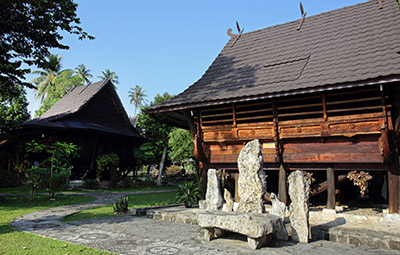
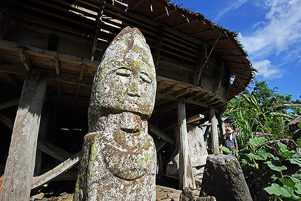
- Lalai I/II village (1.17183, 97.60525), this traditional village is located 2 km off the main road on the left (east) side. It is possible to drive part of the way. The last part is a nice walk to the village where there are several traditional houses and a large anthropomorphic megalith as well as many smaller megaliths.
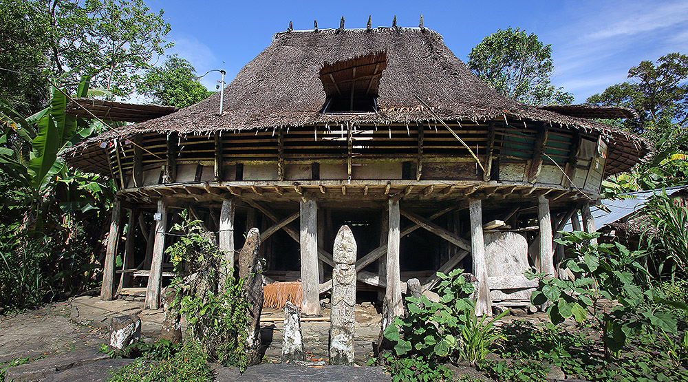
Lalai I/II village in Hiliserangkai sub-district.
Gido and Mau sub-districts
This area is reached by following the main west coast road south from Gunungsitoli. It is the main road to the South (Teluk Dalam) and is clearly marked. Gido is just a couple of kilometres south of the airport. The following sites are all on the right (west) side of the road.
- Baho Waterfall in Ladea village is located c. 2 km from the main road. Turn off the main road at Lolozai village.
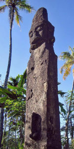
Tuhemberua Megalith
West of the Gido district capital Hiliweto are a number of villages with megaliths and traditional houses. Initially the road is good but it gets progressively worse as it enters Mau sub-district further west.
- Lahemo village, Gido; 1 megalith and ancestral graves of the Ho clan, one of the first clans of the Nias tribe.
- Dekha village, Ma’u; 1 traditional house and 2 megalithic sites.
- Lewa-lewa village, Ma’u: 1 megalith.
- Tuhemberua village, Ma’u; a large megalith with human features called Hilimbaruzö.
Idanögawo & Ulugawo sub-districts
This area is located 50 km south of Gunungsitoli along the main road. Most of the attractions are near the small town of Tetehosi.
- Zangao Cave (Togi Zangoa); just before Tetehosi turn right 200 meters before crossing the bridge. The cave entrance is a short walk up the hill.
- Tetehosi Hotsprings; local people often bring visitors to the hot springs near Tetehosi village. Since the 2005 earthquake the water is no longer flowing and it is a rather underwhelming experience. Follow the signs (air panas = hot water) and drive west out of town.
- Oladanö village near Tetehosi hotspring has two traditional houses.
- Doli, Sisobahili and Sifaoro’asi villages (0.98391, 97.71439); continue on the same road westward passing many picturesque villages and beautiful scenery along the way. After 7 km the road reaches Doli village. Park in the small bazaar and walk across the river (careful after heavy rain) 100 meters north of the unfinished bridge. Follow the narrow stone path uphill and you will reach a cluster of villages with very interesting traditional houses. The first house is in Doli village. Further up along the trail are more houses in Sisobahili and Sifaoro’asi villages. There are some beautiful stone work along the way; terraces, walls and steps lined by megaliths.
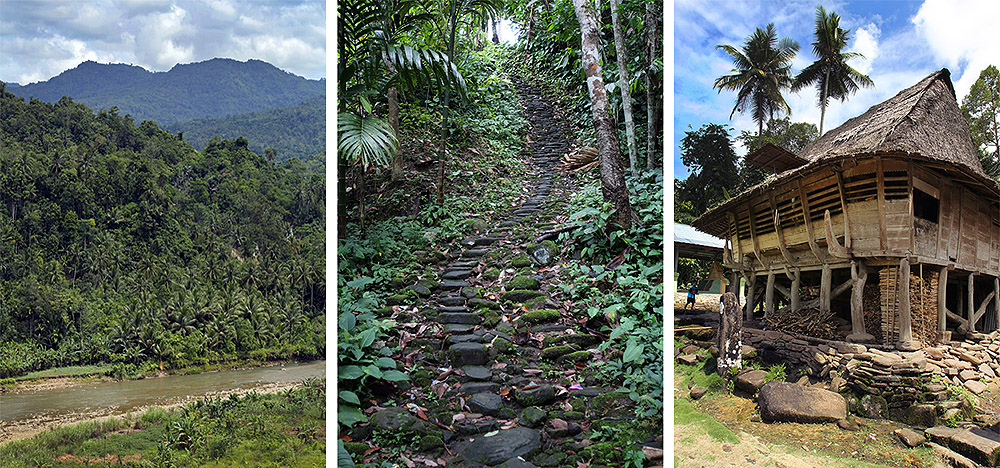
The road to Sisobahili village in Ulugawo sub-district.
Bawolato sub-district
This is the most southern part of Nias District bordering South Nias.
- Sifaoro’asi Uluhou village (0.93329, 97.80112) has 3 traditional houses built in the Gomo style. From the main south-north road turn off (left) at the Gomo sign. This road actually reaches Gomo but is rarely used because the last section is so bad. Drive along a very scenic road which is in good condition for 7 km. The first two houses on top of a hill on the left side are rather dilapidated but the third house on the right side have some incredible ornamental wood carvings, maybe the best in all of Nias district.
- Hou Waterfall (0.91942, 097.80257). Waterfall at the end of a very narrow cave like gorge. The gorge is over 100 meters long with some absolutely spectacular formations inside. Continue on the road past Sifaoro’asi Uluhou village until reaching Hou river. Park and cross the river next to the unfinished bridge (or drive across if you travel by motorbike). Drive c. 500 meters along the road and turn right on the small track leading to a hydro station. Cross the creek and walk across the weir at the pump house. Above the hydro station the river has formed a small lagoon. Swim into the small opening under the waterfall to reach the gorge. Note that the cavern can only be entered by swimming.
- Mo’ambolo Waterfall near Hiliwarökha village. located c 1.5 km walk from the main road. Start 500 meters after Mola river bridge.
- Sisarahili Bawolato village (0.931619, 97.872822), traditional house next to the main road on the right (west) side. The house still has thatched roof and there are many interesting wood carvings on the front in the same style as houses from the Gomo area.

Ornamental wood carvings on traditional houses in Bawolato sub-district.
Services
There is no accommodation in Nias Regency. Visitors to Nias Regency usually base themselves in Gunungsitoli and drive to Nias Regency (1-2 hours, depending on where you go.)
There are a few simple eateries along the main north-south road. Fuel can be bought from hand pumps or in bottles along the way. Small boats to the islands can be hired in Bözihöna and Sohoya villages.



 Onolimbu Kecil, also known as Pulau Musi
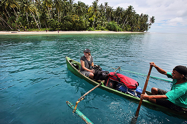 Onolimbu Island excursion
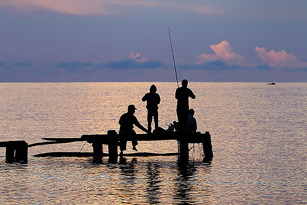 Sunset fishing in Bözihöna
 Boat trip from Gunungsitoli to Islands off Nias
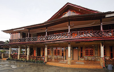
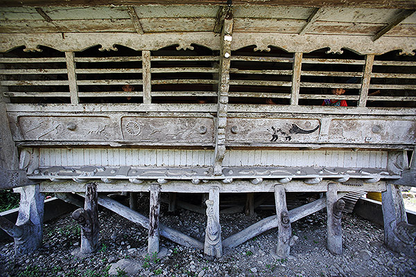 Traditional Nias house in Sisarahili Bawolato village
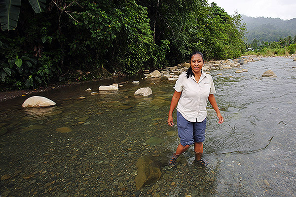 River crossing in Ulugawo sub-district